|
Total Run This Leg:
1,884.2
Nautical Miles
Total Average Speed: 5.23 Knots
Hours / Days This Leg: 360.5 Hours, 15.02 Days
Distance To Go This Leg: 1,063.6 Nautical Miles
Estimated Time Of Arrival: 7:00 a.m., Saturday, October 16
Present Course: 117 Degrees, Southeasterly
Winds: West Southwest at 12 Knots
Seas: 2 Foot
Swells: Southwest at 7 Feet
Barometric Pressure: 1010 Millibars
Air Temperature: 80 Degrees
Sea Temperature: 80.5 Degrees
Visibility: 10 Miles +
Skies: Partly Cloudy
Sea Floor: Ocean depths at this point are between 2,140 and 2,150 Fathoms, or
12,840 and 12,900 Feet Position:
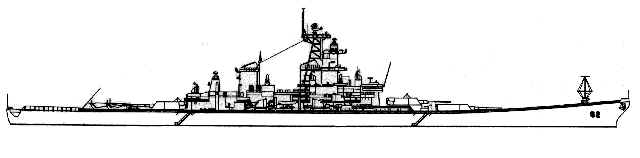
USS
New Jersey is now 153 Nautical Miles Southwest of the Rio Suchiate, the river boundary
between Mexico and Guatemala. At New Jersey's same latitude of 13'-16" North,
and due East of her present position, is the Golfo de Fonseca. Here, the coasts of
El Salvador and Honduras front this Gulf.
New Jersey will continue to pass far enough away from
these Central American nations to avoid seeing and appreciating them, which according to
"Sailing Directions" proves unfortunate. "Several prominent volcanic
peaks rise on both sides of the Gulf entrance," it says, "and a number of high
and conspicuous islands lie within the inner part. "Their description sounds
appealing.
Weather
The Tropical Cyclone Formation Alert that the Captain
received from the Naval Pacific Meteorological Oceanographic Center in San Diego last
night was canceled tonight. There are "no other organized areas of convection
along your track at this time," tonight's advisory predicts.
Communications
It has become such a routine reliability and success that
one tends to ignore the possibility of failure. But systems falter and sometimes
fail. If any fragile link of our communications system failed, it would all fail.
These reports would then assume a much different character, and would lack timeliness,
detail and extensive narrative.
Gratefully, for nearly a full month, day in and day out,
the system has not only performed flawlessly, but has become an extension of our daily
expectations, such as good food, good weather, good accommodations, and a Captain and crew
who couldn't be better, for the USS New Jersey or this messenger.
The credit for this flawless sea-going, marine satellite
communications system goes to LandSea Systems of Virginia Beach, Virginia. They
supplied the New Jersey state Department of Military and Veterans Affairs with this
package that occupies very little space, yet delivers a constant, 24 hour, 7 day a week
signal for email data and digital photo transmissions that are received and posted on the
USS New Jersey web site.
LandSea Systems' equipment also gives us satellite phone
capacity for voice transmission which has also been error free. The COMSAT Corp. of
Bethesda, MD has provided the remarkably reliable satellite connection that our data/voice
transmissions have enjoyed without interruption from day one, September 12. At the
outset of the voyage, we used COMSAT's linkage to the Inmarsat Pacific Ocean Region
satellite, and switched to its Atlantic Ocean Region satellite when USS New Jersey passed
the Southern tip of Baja California.
With sea swells from 1 Foot to 12, the rolling and
tossing of the equipment's tug platform brings the steady satellite signal into constant
question. But even when the Sea Victory's pilothouse swings and sways with these
Pacific waves and swells, the signal remains, the data uploads, and the web site updates.
Our thanks to LandSea Systems, COMSAT Corporation, and,
of course, Crowley Marine Services, for their accommodations, generosity and reliability.
If not for them, these reports would be something else entirely, and we're not
certain what.
Captain Kaare Ogaard's generosity is also greatly
appreciated. He has given us the space to work, the time to do it, and he has
fulfilled our every curiosity to date. Thank you, Captain.
Submitted by Bob Wernet onboard the Sea Victory.
|